


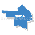
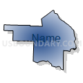
Lincoln, Warren, Audrain, Pike & Montgomery Counties PUMA, Missouri
About
Outline

Summary
| Unique Area Identifier | 193275 |
| Name | Lincoln, Warren, Audrain, Pike & Montgomery Counties PUMA |
| State | Missouri |
| Area (square miles) | 3,001.78 |
| Land Area (square miles) | 2,954.08 |
| Water Area (square miles) | 47.70 |
| % of Land Area | 98.41 |
| % of Water Area | 1.59 |
| Latitude of the Internal Point | 39.09426680 |
| Longtitude of the Internal Point | -91.34206370 |
Maps


Graphs
Select a template below for downloading or customizing gragh for Lincoln, Warren, Audrain, Pike & Montgomery Counties PUMA, Missouri


Neighbors
Neighoring Public Use Microdata Area (by Name) Neighboring Public Use Microdata Area on the Map
- Adams, Pike, Brown, Schuyler & Mason Counties PUMA, IL
- Boone County PUMA, MO
- Cass, Morgan, Scott, Greene, Macoupin, Jersey & Calhoun Counties PUMA, IL
- Cole, Callaway, Moniteau & Osage Counties PUMA, MO
- Franklin County PUMA, MO
- Northeast Missouri PUMA, MO
- Pettis, Randolph, Saline, Cooper, Howard, Carroll & Chariton Counties PUMA, MO
- Phelps, Crawford, Dent, Gasconade & Maries Counties PUMA, MO
- St. Charles County (Northeast) PUMA, MO
- St. Charles County (Northwest) PUMA, MO
- St. Charles County (South) PUMA, MO
Top 10 Neighboring County (by Population) Neighboring County on the Map
- St. Charles County, MO (360,485)
- Boone County, MO (162,642)
- Franklin County, MO (101,492)
- Lincoln County, MO (52,566)
- Callaway County, MO (44,332)
- Warren County, MO (32,513)
- Audrain County, MO (25,529)
- Randolph County, MO (25,414)
- Pike County, MO (18,516)
- Pike County, IL (16,430)
Top 10 Neighboring County Subdivision (by Population) Neighboring County Subdivision on the Map
- Boone township, St. Charles County, MO (41,639)
- Wentzville township, St. Charles County, MO (39,997)
- Rivers township, St. Charles County, MO (22,257)
- Washington township, Franklin County, MO (13,982)
- Bedford township, Lincoln County, MO (12,599)
- Monroe township, Lincoln County, MO (11,155)
- Clark township, Lincoln County, MO (10,395)
- Salt River township, Audrain County, MO (9,497)
- Hickory Grove township, Warren County, MO (9,326)
- Rocky Fork township, Boone County, MO (8,397)
Top 10 Neighboring Place (by Population) Neighboring Place on the Map
- Washington city, MO (13,982)
- Mexico city, MO (11,543)
- Troy city, MO (10,540)
- Warrenton city, MO (7,880)
- Bowling Green city, MO (5,334)
- Centralia city, MO (4,027)
- Vandalia city, MO (3,899)
- Louisiana city, MO (3,364)
- Wright City city, MO (3,119)
- Montgomery City city, MO (2,834)
Top 10 Neighboring Elementary School District (by Population) Neighboring Elementary School District on the Map
- Renick R-V School District, MO (1,210)
- Middle Grove C-1 School District, MO (691)
- Boncl R-X School District, MO (487)
Top 10 Neighboring Unified School District (by Population) Neighboring Unified School District on the Map
- Francis Howell School District, MO (113,553)
- Fort Zumwalt R-II School District, MO (110,048)
- Wentzville R-IV School District, MO (71,390)
- Troy R-III School District, MO (33,238)
- Washington School District, MO (31,485)
- Hannibal School District, MO (22,813)
- Warren County R-III School District, MO (18,599)
- Mexico 59 School District, MO (15,366)
- Bowling Green R-I School District, MO (11,119)
- Wright City R-II School District, MO (10,768)
Top 10 Neighboring State Legislative District Lower Chamber (by Population) Neighboring State Legislative District Lower Chamber on the Map
- State House District 97, IL (103,784)
- State House District 13, MO (72,365)
- State House District 11, MO (48,326)
- State House District 17, MO (43,513)
- State House District 99, MO (42,788)
- State House District 21, MO (39,438)
- State House District 20, MO (38,233)
- State House District 9, MO (36,616)
- State House District 6, MO (35,970)
- State House District 109, MO (35,780)
Top 10 Neighboring State Legislative District Upper Chamber (by Population) Neighboring State Legislative District Upper Chamber on the Map
- State Senate District 2, MO (242,885)
- State Senate District 49, IL (207,061)
- State Senate District 26, MO (189,096)
- State Senate District 16, MO (188,295)
- State Senate District 19, MO (188,056)
- State Senate District 6, MO (181,242)
- State Senate District 23, MO (170,166)
- State Senate District 18, MO (159,547)
Top 10 Neighboring 111th Congressional District (by Population) Neighboring 111th Congressional District on the Map
- Congressional District 2, MO (706,622)
- Congressional District 9, MO (684,101)
- Congressional District 17, IL (634,792)
Top 10 Neighboring Census Tract (by Population) Neighboring Census Tract on the Map
- Census Tract 8103.04, Lincoln County, MO (10,149)
- Census Tract 8103.01, Lincoln County, MO (9,138)
- Census Tract 8104, Lincoln County, MO (8,490)
- Census Tract 8201.02, Warren County, MO (8,412)
- Census Tract 19.02, Boone County, MO (8,249)
- Census Tract 8103.03, Lincoln County, MO (8,180)
- Census Tract 8202.02, Warren County, MO (7,508)
- Census Tract 8003, Franklin County, MO (7,476)
- Census Tract 8201.01, Warren County, MO (7,236)
- Census Tract 8201.03, Warren County, MO (7,141)
Top 10 Neighboring 5-Digit ZIP Code Tabulation Area (by Population) Neighboring 5-Digit ZIP Code Tabulation Area on the Map
- 63301, MO (48,514)
- 63366, MO (46,175)
- 63385, MO (35,750)
- 63379, MO (23,348)
- 63090, MO (21,524)
- 63383, MO (15,770)
- 65265, MO (15,409)
- 63390, MO (9,760)
- 63334, MO (8,569)
- 65240, MO (7,590)